


UNV035 Voting District, St. Louis County, Missouri
About
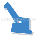
Outline

Summary
| Unique Area Identifier | 611161 |
| Name | UNV035 Voting District |
| County | St. Louis County |
| State | Missouri |
| Area (square miles) | 0.10 |
| Land Area (square miles) | 0.10 |
| Water Area (square miles) | 0.00 |
| % of Land Area | 100.00 |
| % of Water Area | 0.00 |
| Latitude of the Internal Point | 38.67648280 |
| Longtitude of the Internal Point | -90.35266930 |
Maps


Graphs
Select a template below for downloading or customizing gragh for UNV035 Voting District, St. Louis County, Missouri


Neighbors
Neighoring Voting District (by Name) Neighboring Voting District on the Map
- CC207 Voting District, St. Louis County, MO
- MID031 Voting District, St. Louis County, MO
- UNV034 Voting District, St. Louis County, MO
- UNV036 Voting District, St. Louis County, MO
- UNV038 Voting District, St. Louis County, MO
- UNV042 Voting District, St. Louis County, MO
Top 10 Neighboring County Subdivision (by Population) Neighboring County Subdivision on the Map
- Creve Coeur township, St. Louis County, MO (36,560)
- Midland township, St. Louis County, MO (34,636)
- University township, St. Louis County, MO (34,281)